File:GreatHill Invasives Map 2024-1.png

Size of this preview: 503 × 600 pixels. Other resolutions: 1,718 × 2,048 pixels | 2,664 × 3,176 pixels.
Original file (2,664 × 3,176 pixels, file size: 3.93 MB, MIME type: image/png)
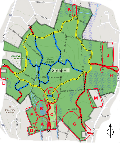
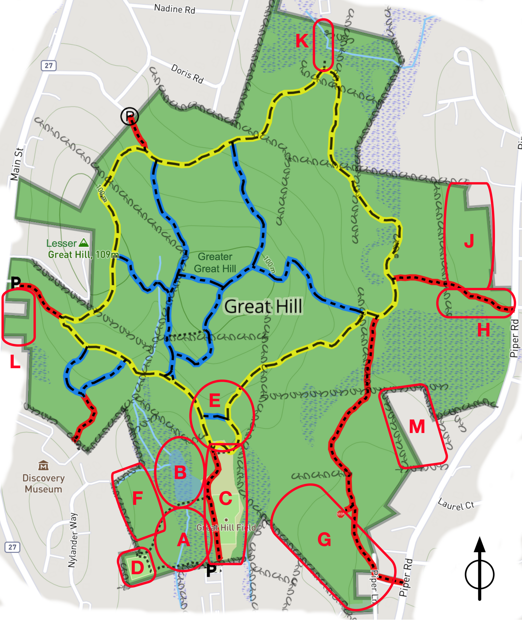
Map of areas of Great Hill Conservation Area which have been worked to remove invasive plants
File history
Click on a date/time to view the file as it appeared at that time.
| Date/Time | Thumbnail | Dimensions | User | Comment | |
|---|---|---|---|---|---|
| current | 22:45, 5 August 2025 | | 2,664 × 3,176 (3.93 MB) | Watlington (talk | contribs) | Added area N |
| 03:37, 30 August 2024 |  | 2,664 × 3,176 (3.92 MB) | Watlington (talk | contribs) |
You cannot overwrite this file.
File usage
The following page uses this file: