File:NagogHillInvasivesMap.png: Difference between revisions
Jump to navigation
Jump to search
Watlington (talk | contribs) No edit summary |
(No difference)
|
Latest revision as of 17:19, 7 November 2024
A map of the Nagog Hill Conservation Area, showing some of the areas being worked for invasive plants
File history
Click on a date/time to view the file as it appeared at that time.
| Date/Time | Thumbnail | Dimensions | User | Comment | |
|---|---|---|---|---|---|
| current | 17:19, 7 November 2024 | 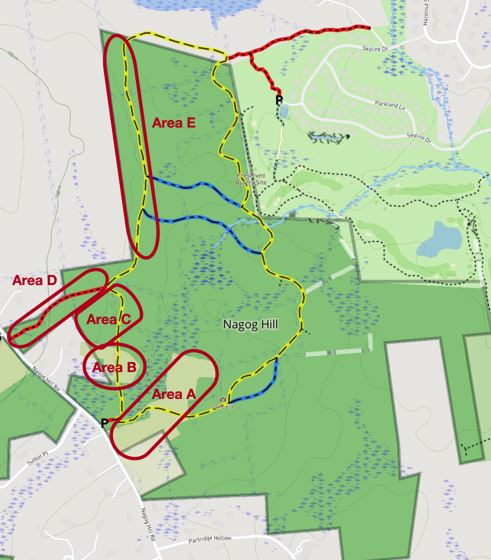 | 2,034 × 2,322 (2.01 MB) | Watlington (talk | contribs) |
You cannot overwrite this file.
File usage
The following page uses this file: