File:GreatHill Invasives Map 2024.png: Difference between revisions
Jump to navigation
Jump to search
Watlington (talk | contribs) No edit summary |
(No difference)
|
Latest revision as of 03:02, 30 August 2024
A map of areas on Great Hill Conservation Land where invasive plants are being addressed or ignored
File history
Click on a date/time to view the file as it appeared at that time.
| Date/Time | Thumbnail | Dimensions | User | Comment | |
|---|---|---|---|---|---|
| current | 03:02, 30 August 2024 | 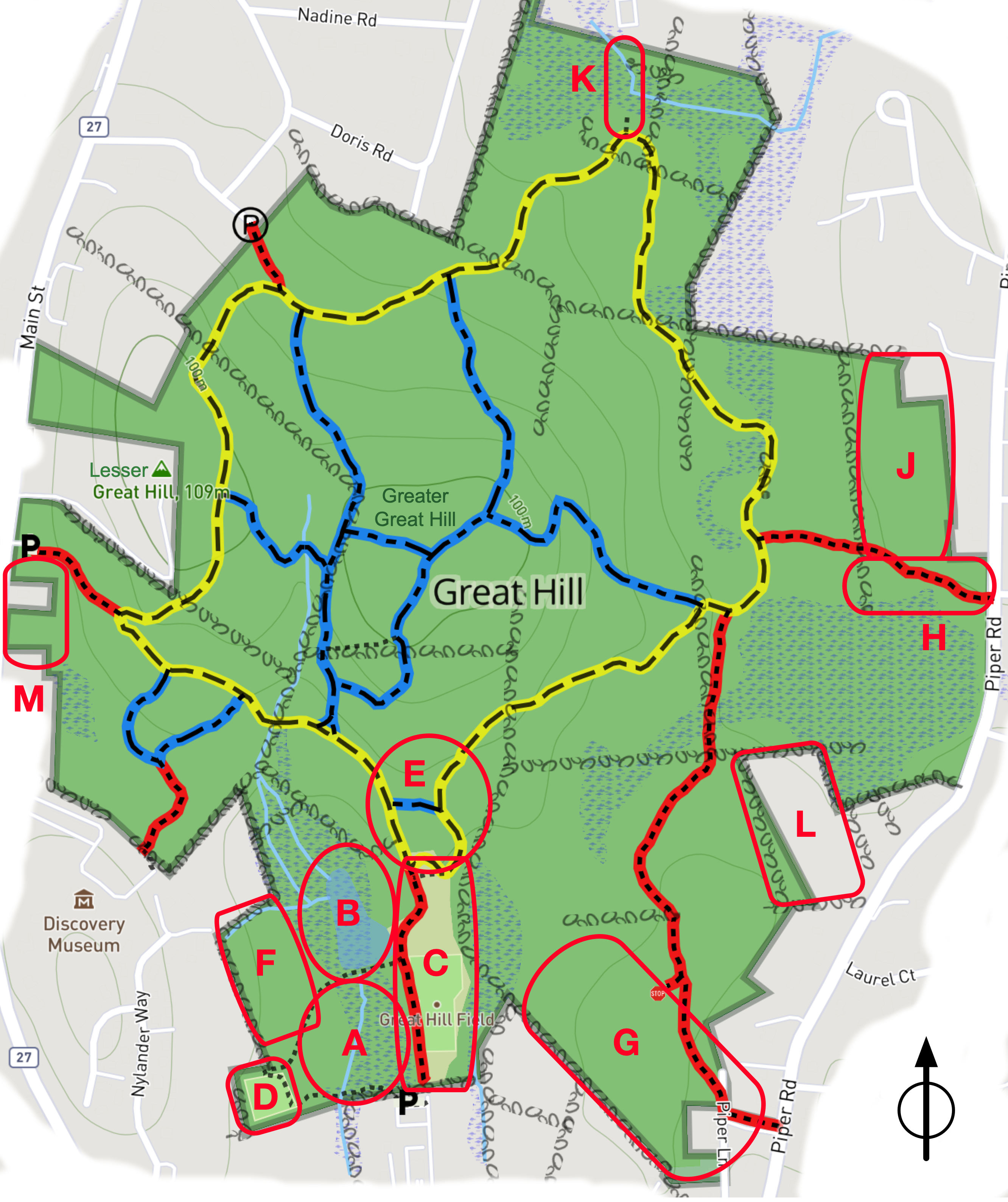 | 2,664 × 3,176 (3.92 MB) | Watlington (talk | contribs) |
You cannot overwrite this file.
File usage
There are no pages that use this file.