File:Gaebel-Magoun Invasive Species Areas.png: Difference between revisions
Jump to navigation
Jump to search
Watlington (talk | contribs) No edit summary |
(No difference)
|
Latest revision as of 05:23, 24 February 2024
A map showing the additions to Great Hill in the early 2000s, the Gaebel and Magoun lands, showing the ares of invasive plant species work.
File history
Click on a date/time to view the file as it appeared at that time.
| Date/Time | Thumbnail | Dimensions | User | Comment | |
|---|---|---|---|---|---|
| current | 05:23, 24 February 2024 | 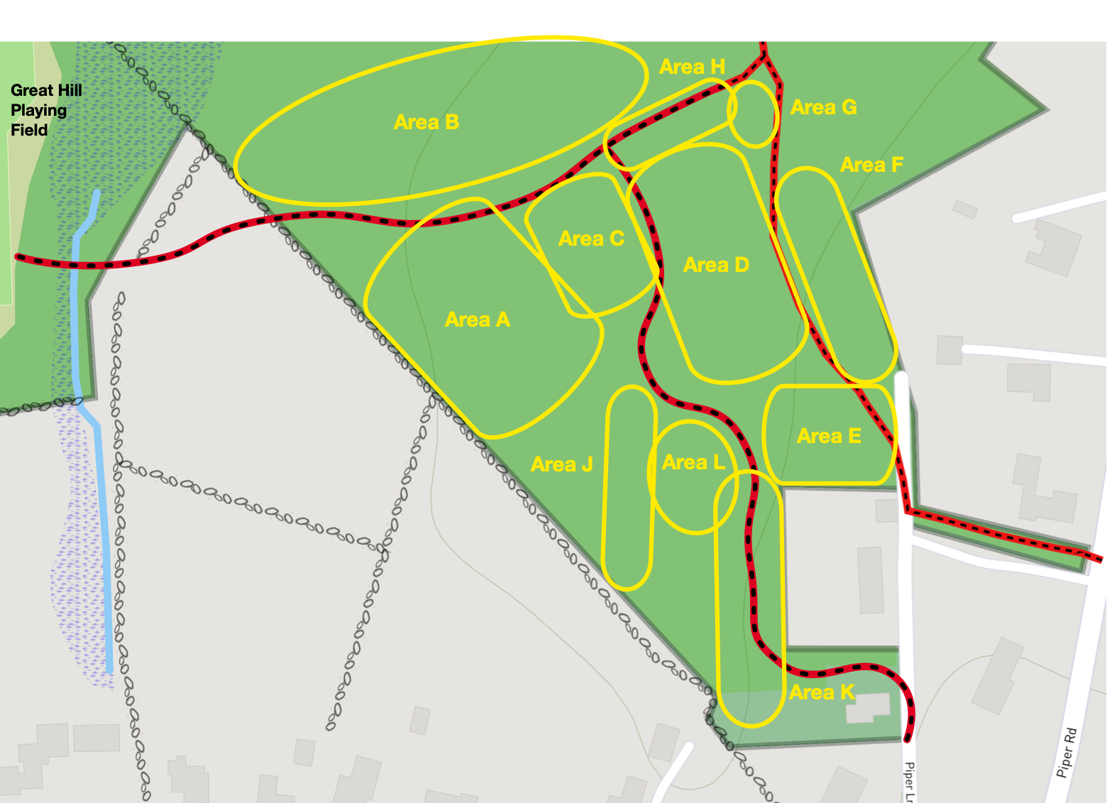 | 1,560 × 1,131 (645 KB) | Watlington (talk | contribs) |
You cannot overwrite this file.
File usage
The following page uses this file: